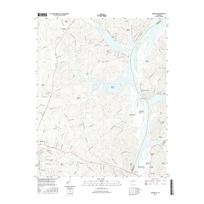
2016 Map of Jeannette
USGS Topo · Published 2016About this map
Kentucky Lake dominates the eastern landscape of this Tennessee River valley corridor, where the Decatur and Perry county line follows the water. The area is characterized by a high density of family-named hollows and bottoms, such as Bateman Bottom and Campbell Hollow, suggesting a long-standing pattern of localized valley settlement. Near the town of Parsons, the land rises toward Sparks Ridge and several prominent bluffs, including Lady Finger Bluff and Alley Bluff overlooking the wide river channel.
Find a feature on this map
152 named features on this map. Tap any name to fly to it.
Don’t see what you’re looking for? This feature index may not catch every label — zoom into the map to look around manually.
Map Details
Editions of this 2016 Jeannette Map
This is the sole edition of this map. No revisions or reprints were ever made.
Other maps of this area

1936 · Pine View
USGS Topo · 1:24,000

1936 · Scotts Hill
USGS Topo · 1:24,000

1936 · Parsons
USGS Topo · 1:24,000

1936 · Daniels Landing
USGS Topo · 1:24,000

1936 · Jeannette
USGS Topo · 1:24,000

1936 · Sugar Tree
USGS Topo · 1:24,000

1936 · Cavvia
USGS Topo · 1:24,000

1936 · Perryville
USGS Topo · 1:24,000

1936 · Pope
USGS Topo · 1:24,000

1949 · Perryville
USGS Topo · 1:24,000