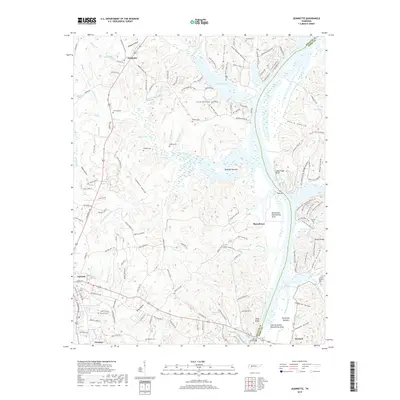
2019 Map of Jeannette
USGS Topo · Published 2019About this map
Kentucky Lake and the winding course of the Tennessee River dominate this landscape near the border of Decatur and Perry counties. The town of Parsons sits in the southwest corner, serving as a gateway to the river bottoms and the high ridges that define the local geography. Several prominent landforms overlook the water, including Lady Finger Bluff and Alley Bluff, while the river narrows significantly at the aptly named The Narrows. This topography necessitated large-scale water management projects, evidenced by the Busseltown Dewatering Area and East Perryville Dewatering Area. Local history is preserved in numerous family and community burial grounds scattered across the terrain, from Parsons Cem to the Walker Cem and Jennings Cem. The Alvin C York Bridge provides a vital crossing point, linking the valley's disparate settlements and hollows.
Find a feature on this map
167 named features on this map. Tap any name to fly to it.
Don’t see what you’re looking for? This feature index may not catch every label — zoom into the map to look around manually.
Map Details
Editions of this 2019 Jeannette Map
This is the sole edition of this map. No revisions or reprints were ever made.
Other maps of this area

1936 · Pine View
USGS Topo · 1:24,000

1936 · Scotts Hill
USGS Topo · 1:24,000

1936 · Parsons
USGS Topo · 1:24,000

1936 · Daniels Landing
USGS Topo · 1:24,000

1936 · Jeannette
USGS Topo · 1:24,000

1936 · Sugar Tree
USGS Topo · 1:24,000

1936 · Cavvia
USGS Topo · 1:24,000

1936 · Perryville
USGS Topo · 1:24,000

1936 · Pope
USGS Topo · 1:24,000

1949 · Perryville
USGS Topo · 1:24,000