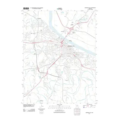
2011 Map of Jefferson City
USGS Topo · Published 2011About this map
Jefferson City sits at the heart of this 2011 Missouri survey, centered on the Missouri River and the Jefferson City Reach. The state capital's academic and civic foundations are prominent, notably the campus of Lincoln University and the Lincoln University Farm. The riverfront geography defines the region, from the northern airfield at Jefferson City Memorial Airport to the western railroad history suggested by Cole Junction. High ground south of the river is dense with sites of genealogical interest, including the Jefferson City National Cemetery, Woodlawn Cemetery, and Saint Peters Cemetery. Beyond the urban core, the terrain transitions into the valleys of Wears Creek and the meandering Moreau River, where local landmarks like Frog Hollow and Hough Park Lake dot the landscape.
Find a feature on this map
138 named features on this map. Tap any name to fly to it.
Don’t see what you’re looking for? This feature index may not catch every label — zoom into the map to look around manually.
Map Details
Editions of this 2011 Jefferson City Map
This is the sole edition of this map. No revisions or reprints were ever made.
Other maps of this area

1886 · Jefferson City
USGS Topo · 1:125,000

1888 · Tuscumbia
USGS Topo · 1:125,000

1894 · Tuscumbia
USGS Topo · 1:125,000

1894 · Jefferson City
USGS Topo · 1:125,000

1939 · Jefferson City
USGS Topo · 1:24,000

1939 · Jefferson City
USGS Topo · 1:62,500

1942 · Jefferson City
USGS Topo · 1:62,500

1947 · Jefferson City
USGS Topo · 1:250,000

1948 · Centertown
USGS Topo · 1:62,500

1948 · Meta
USGS Topo · 1:62,500
Featured Places
- Jefferson City, MO
- Holts Summit, MO
- Wardsville, MO
- North Jefferson, Jefferson City
- Cole Junction, Jefferson City