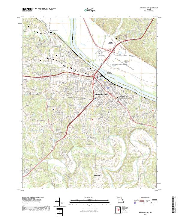
2021 Map of Jefferson City
USGS Topo · Published 2021About this map
The Missouri River carves a wide path through the center of this 2021 study, separating the seat of state government from the northern floodplains of Callaway Co. In Jefferson City, the landscape is dominated by institutional landmarks such as Lincoln University, the Supreme Court of Missouri, and the Cole County Courthouse. The urban center gives way to a complex series of ridges and hollows to the south and west, including Frog Hollow and Diamond Ridge, where the terrain begins its descent toward the winding Moreau River. This modern survey illustrates the proximity of the capital's historic core to the expansive Jefferson City Memorial Airport and the recreational Katy Trl on the northern bank. Researchers can identify numerous family and community burial grounds, from the centrally located Saint Peters Cem Number 1 to the more outlying Rouschelback Cem near Wardsville.
Find a feature on this map
234 named features on this map. Tap any name to fly to it.
Don’t see what you’re looking for? This feature index may not catch every label — zoom into the map to look around manually.
Map Details
Editions of this 2021 Jefferson City Map
This is the sole edition of this map. No revisions or reprints were ever made.
Other maps of this area

1886 · Jefferson City
USGS Topo · 1:125,000

1888 · Tuscumbia
USGS Topo · 1:125,000

1894 · Tuscumbia
USGS Topo · 1:125,000

1894 · Jefferson City
USGS Topo · 1:125,000

1939 · Jefferson City
USGS Topo · 1:24,000

1939 · Jefferson City
USGS Topo · 1:62,500

1942 · Jefferson City
USGS Topo · 1:62,500

1947 · Jefferson City
USGS Topo · 1:250,000

1948 · Centertown
USGS Topo · 1:62,500

1948 · Meta
USGS Topo · 1:62,500
Featured Places
- Jefferson City, MO
- Holts Summit, MO
- Wardsville, MO
- North Jefferson, Jefferson City
- Cole Junction, Jefferson City