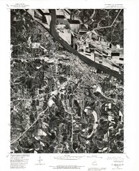
1980 Map of Jefferson City
USGS Topo · Published 1981About this map
Jefferson City sits at the center of this 1980 orthophotograph, where the dense urban grid meets the winding course of the Missouri River. The aerial perspective emphasizes the stark contrast between the city's concentrated development and the vast, patterned agricultural bottomlands of North Jefferson and Cedar City directly across the water. At the heart of the capital, the Capitol building stands as a distinct landmark overlooking the riverbank.
Find a feature on this map
8 named features on this map. Tap any name to fly to it.
Don’t see what you’re looking for? This feature index may not catch every label — zoom into the map to look around manually.
Map Details
Editions of this 1980 Jefferson City Map
This is the sole edition of this map. No revisions or reprints were ever made.
Other maps of this area

1886 · Jefferson City
USGS Topo · 1:125,000

1888 · Tuscumbia
USGS Topo · 1:125,000

1894 · Tuscumbia
USGS Topo · 1:125,000

1894 · Jefferson City
USGS Topo · 1:125,000

1939 · Jefferson City
USGS Topo · 1:24,000

1939 · Jefferson City
USGS Topo · 1:62,500

1942 · Jefferson City
USGS Topo · 1:62,500

1947 · Jefferson City
USGS Topo · 1:250,000

1948 · Centertown
USGS Topo · 1:62,500

1948 · Meta
USGS Topo · 1:62,500
Featured Places
- Jefferson City, MO
- Holts Summit, MO
- Wardsville, MO
- Cole Junction, Jefferson City
- North Jefferson, Jefferson City