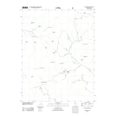
2012 Map of Jefferson
USGS Topo · Published 2012About this map
Jefferson (historical) serves as a focal point for this high-desert landscape in Nye County, marking a site where mining history once pulsed through the canyons. The map details a rugged drainage network including Jefferson Creek and Shoshone Creek, framed by massive features like Spanish Peak and Bull Frame Mountain. This 2012 survey illustrates the remote character of the Toiyabe Range, where high-altitude markers such as Barcelona Summit and Jefferson Summit overlook a terrain carved by Slaughterhouse Canyon and Berlin Canyon. The presence of several named springs, such as Pipe Organ Spring and Sage Hen Spring, indicates the vital water sources that dictated movement through this arid region. Traces of past habitation and seasonal utility remain through labels like Flowers Camp and the winding paths of the Natl Forest Develop Road 010 RD, providing a precise record of the land's contemporary access points and historical markers.
Find a feature on this map
58 named features on this map. Tap any name to fly to it.
Don’t see what you’re looking for? This feature index may not catch every label — zoom into the map to look around manually.
Map Details
Editions of this 2012 Jefferson Map
This is the sole edition of this map. No revisions or reprints were ever made.
Other maps of this area

1907 · Tonopah
USGS Topo · 1:250,000

1908 · Tonopah
USGS Topo · 1:250,000

1956 · Tonopah
USGS Topo · 1:250,000

1959 · Tonopah
USGS Topo · 1:250,000

1962 · Tonopah
USGS Topo · 1:250,000

1971 · Belmont East
USGS Topo · 1:24,000

1971 · Corcoran Canyon
USGS Topo · 1:24,000

1971 · Manhattan
USGS Topo · 1:24,000

1971 · Belmont West
USGS Topo · 1:24,000

1971 · Jefferson
USGS Topo · 1:24,000