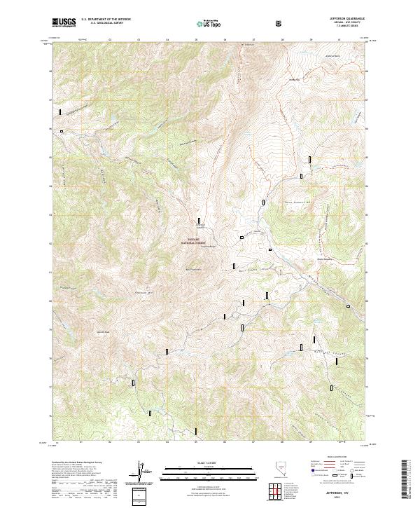
2021 Map of Jefferson
USGS Topo · Published 2021About this map
Toiyabe National Forest encompasses this high-altitude landscape in Nye County, dominated by the ridges of the Toquima Range. The terrain is defined by extreme vertical relief, stretching from the peaks of Mt Jefferson and Shoshone Mtn down through a complex network of drainages. These canyons, including Jefferson Canyon, Berlin Canyon, and Slaughterhouse Canyon, serve as the primary corridors through the high country. Water sources are critical landmarks in this arid environment, with several named points such as Wild Horse Spring, Soldier Spring, and Pipe Organ Spring appearing along the slopes. A network of trails, such as the Mount Jefferson Trail and Windy Pass Trail, provides the primary means of navigation through the mountain passes. The map also reveals localized features like Round Meadow and Andrews Basin, which offer rare breaks in the steep topography of the range.
Find a feature on this map
62 named features on this map. Tap any name to fly to it.
Don’t see what you’re looking for? This feature index may not catch every label — zoom into the map to look around manually.
Map Details
Editions of this 2021 Jefferson Map
This is the sole edition of this map. No revisions or reprints were ever made.
Other maps of this area

1907 · Tonopah
USGS Topo · 1:250,000

1908 · Tonopah
USGS Topo · 1:250,000

1956 · Tonopah
USGS Topo · 1:250,000

1959 · Tonopah
USGS Topo · 1:250,000

1962 · Tonopah
USGS Topo · 1:250,000

1971 · Belmont East
USGS Topo · 1:24,000

1971 · Corcoran Canyon
USGS Topo · 1:24,000

1971 · Manhattan
USGS Topo · 1:24,000

1971 · Belmont West
USGS Topo · 1:24,000

1971 · Jefferson
USGS Topo · 1:24,000