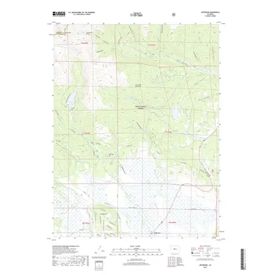
2019 Map of Jefferson
USGS Topo · Published 2019About this map
Jefferson sits at the base of the high country in Park County, where the plains of the South Park basin meet the southern reaches of the Continental Divide. This landscape is defined by the headwaters of several major waterways, including the N Fork S Platte River, Michigan Creek, and Jefferson Creek, which flow through wide valleys such as Hall Valley and the wetlands surrounding Baker Lake. The topography rises sharply to the north and west toward Whale Peak and the alpine heights of the Pike National Forest.
Find a feature on this map
59 named features on this map. Tap any name to fly to it.
Don’t see what you’re looking for? This feature index may not catch every label — zoom into the map to look around manually.
Map Details
Editions of this 2019 Jefferson Map
This is the sole edition of this map. No revisions or reprints were ever made.
Other maps of this area

1903 · Georgetown
USGS Topo · 1:62,500

1905 · Georgetown
USGS Topo · 1:62,500

1924 · Montezuma
USGS Topo · 1:62,500

1926 · Montezuma
USGS Topo · 1:62,500

1933 · Montezuma
USGS Topo · 1:62,500

1937 · Como
USGS Topo · 1:62,500

1945 · Mount Logan
USGS Topo · 1:24,000

1948 · Mount Logan
USGS Topo · 1:24,000

1953 · Denver
USGS Topo · 1:250,000

1957 · Denver
USGS Topo · 1:250,000