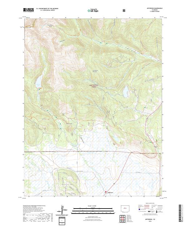
2022 Map of Jefferson
USGS Topo · Published 2022About this map
Jefferson sits at the southern edge of this high-altitude landscape, serving as a gateway to the diverse hydrology and alpine terrain of the Pike National Forest. The map documents a complex network of water management and natural drainages, including the Brubaker Ditch, Sheep Rock Ditch, and Lininger Ditch that traverse the basin. These man-made channels reflect the historical and ongoing importance of water rights in the region, diverting flow from natural courses like Jefferson Cr and Michigan Cr.
Find a feature on this map
63 named features on this map. Tap any name to fly to it.
Don’t see what you’re looking for? This feature index may not catch every label — zoom into the map to look around manually.
Map Details
Editions of this 2022 Jefferson Map
This is the sole edition of this map. No revisions or reprints were ever made.
Other maps of this area

1903 · Georgetown
USGS Topo · 1:62,500

1905 · Georgetown
USGS Topo · 1:62,500

1924 · Montezuma
USGS Topo · 1:62,500

1926 · Montezuma
USGS Topo · 1:62,500

1933 · Montezuma
USGS Topo · 1:62,500

1937 · Como
USGS Topo · 1:62,500

1945 · Mount Logan
USGS Topo · 1:24,000

1948 · Mount Logan
USGS Topo · 1:24,000

1953 · Denver
USGS Topo · 1:250,000

1957 · Denver
USGS Topo · 1:250,000