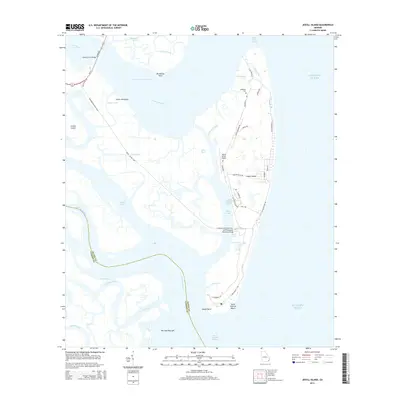
2014 Map of Jekyll Island
USGS Topo · Published 2014About this map
Jekyll Island is defined by its complex network of salt marshes and tidal creeks as they meet the Atlantic Ocean in Glynn County. The landscape is a maze of waterways, including the Intracoastal Waterway, Brunswick River, and the Mud River, surrounding landforms like Jointer Island and Cedar Hammock. On the island's interior, local history is preserved at the DuBignon Cem, reflecting the area's long-standing family legacies. Modern infrastructure is evident through the Sidney Lanier Bridge and the M E Thompson Memorial Bridge, which connect this coastal terrain to the mainland.
Find a feature on this map
56 named features on this map. Tap any name to fly to it.
Don’t see what you’re looking for? This feature index may not catch every label — zoom into the map to look around manually.
Map Details
Editions of this 2014 Jekyll Island Map
This is the sole edition of this map. No revisions or reprints were ever made.
Other maps of this area

1918 · Cumberland Island
USGS Topo · 1:62,500

1918 · Bladen
USGS Topo · 1:62,500

1918 · Kingsland
USGS Topo · 1:62,500

1930 · Cumberland Island
USGS Topo · 1:62,500

1939 · Bladen
USGS Topo · 1:62,500

1945 · Brunswick
USGS Topo · 1:62,500

1945 · Cumberland Island
USGS Topo · 1:62,500

1946 · Brunswick
USGS Topo · 1:250,000

1948 · Jacksonville
USGS Topo · 1:250,000

1948 · Brunswick
USGS Topo · 1:250,000