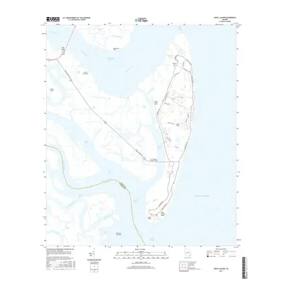
2017 Map of Jekyll Island
USGS Topo · Published 2017About this map
Jekyll Island is the center of this coastal survey, showcasing its complex network of tidal creeks and marshlands. The island's geography is defined by the Intracoastal Waterway and the Brunswick River, which separate the barrier island from the mainland near Brunswick Point. The map provides detailed road layouts for the island's residential and recreational corridors, including Riverview Dr and N Beachview Dr, while marking key local landmarks such as the Jekyll Island Airport.
Find a feature on this map
53 named features on this map. Tap any name to fly to it.
Don’t see what you’re looking for? This feature index may not catch every label — zoom into the map to look around manually.
Map Details
Editions of this 2017 Jekyll Island Map
This is the sole edition of this map. No revisions or reprints were ever made.
Other maps of this area

1918 · Cumberland Island
USGS Topo · 1:62,500

1918 · Bladen
USGS Topo · 1:62,500

1918 · Kingsland
USGS Topo · 1:62,500

1930 · Cumberland Island
USGS Topo · 1:62,500

1939 · Bladen
USGS Topo · 1:62,500

1945 · Brunswick
USGS Topo · 1:62,500

1945 · Cumberland Island
USGS Topo · 1:62,500

1946 · Brunswick
USGS Topo · 1:250,000

1948 · Jacksonville
USGS Topo · 1:250,000

1948 · Brunswick
USGS Topo · 1:250,000