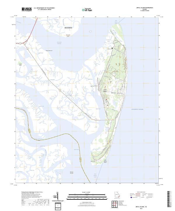
2024 Map of Jekyll Island
USGS Topo · Published 2024About this map
Jekyll Island stands as a prominent barrier feature along the Georgia coast, defined by its intricate network of tidal creeks and maritime forests. This modern survey illustrates the island's unique spatial organization, where the historic DuBignon Cem and heritage corridors like Old Plantation Rd coexist with contemporary infrastructure such as the Jekyll Island Airport. The western marshes, dominated by Jekyll Creek and the Intracoastal Waterway, reveal the complex estuarine environment that separates the island from the mainland near Brunswick.
Find a feature on this map
50 named features on this map. Tap any name to fly to it.
Don’t see what you’re looking for? This feature index may not catch every label — zoom into the map to look around manually.
Map Details
Editions of this 2024 Jekyll Island Map
This is the sole edition of this map. No revisions or reprints were ever made.
Other maps of this area

1918 · Cumberland Island
USGS Topo · 1:62,500

1918 · Bladen
USGS Topo · 1:62,500

1918 · Kingsland
USGS Topo · 1:62,500

1930 · Cumberland Island
USGS Topo · 1:62,500

1939 · Bladen
USGS Topo · 1:62,500

1945 · Brunswick
USGS Topo · 1:62,500

1945 · Cumberland Island
USGS Topo · 1:62,500

1946 · Brunswick
USGS Topo · 1:250,000

1948 · Jacksonville
USGS Topo · 1:250,000

1948 · Brunswick
USGS Topo · 1:250,000