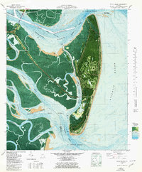
1979 Map of Jekyll Island
USGS Topo · Published 1980About this map
Jekyll Island State Park is documented in this 1970s orthophotomap, showing the intricate balance between coastal recreation and preserved landmarks. The island's northern end is highlighted by the Ruins of Georgias First Brewery and a nearby Cem, indicating the early colonial and agricultural history of this barrier island. The interior reveals mid-century infrastructure including the Jekyll Island Airport and a prominent Golf Course, while the northern access is provided by the Sidney Lanier Bridge crossing the Brunswick River.
Find a feature on this map
36 named features on this map. Tap any name to fly to it.
Don’t see what you’re looking for? This feature index may not catch every label — zoom into the map to look around manually.
Map Details
Editions of this 1979 Jekyll Island Map
This is the sole edition of this map. No revisions or reprints were ever made.
Other maps of this area

1918 · Cumberland Island
USGS Topo · 1:62,500

1918 · Bladen
USGS Topo · 1:62,500

1918 · Kingsland
USGS Topo · 1:62,500

1930 · Cumberland Island
USGS Topo · 1:62,500

1939 · Bladen
USGS Topo · 1:62,500

1945 · Brunswick
USGS Topo · 1:62,500

1945 · Cumberland Island
USGS Topo · 1:62,500

1946 · Brunswick
USGS Topo · 1:250,000

1948 · Jacksonville
USGS Topo · 1:250,000

1948 · Brunswick
USGS Topo · 1:250,000