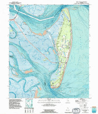
1993 Map of Jekyll Island
USGS Topo · Published 1995About this map
Jekyll Island State Park dominates this coastal survey, illustrating the island's mid-1990s character as a managed recreational and historic landscape. The interior is marked by established infrastructure like the Golf Course and Jekyll Island Airport, alongside spiritual landmarks such as United Ch and Jekyll Chapel. For those tracing local heritage, the Du Bignon Cem provides a tangible link to the island's private ownership era before it became a public park.
Find a feature on this map
36 named features on this map. Tap any name to fly to it.
Don’t see what you’re looking for? This feature index may not catch every label — zoom into the map to look around manually.
Map Details
Editions of this 1993 Jekyll Island Map
This is the sole edition of this map. No revisions or reprints were ever made.
Other maps of this area

1918 · Cumberland Island
USGS Topo · 1:62,500

1918 · Bladen
USGS Topo · 1:62,500

1918 · Kingsland
USGS Topo · 1:62,500

1930 · Cumberland Island
USGS Topo · 1:62,500

1939 · Bladen
USGS Topo · 1:62,500

1945 · Brunswick
USGS Topo · 1:62,500

1945 · Cumberland Island
USGS Topo · 1:62,500

1946 · Brunswick
USGS Topo · 1:250,000

1948 · Jacksonville
USGS Topo · 1:250,000

1948 · Brunswick
USGS Topo · 1:250,000