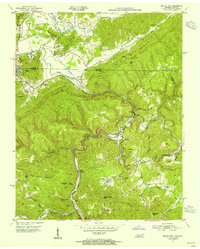
1953 Map of Jellico East
USGS Topo · Published 1955About this map
Pine Mountain dominates this mid-century landscape where the Kentucky Tennessee state line meets. The Louisville and Nashville railroad winds through the narrow valleys, serving a corridor of mountain communities including Jellico, Highcliff, Chaska, and Habersham. Evidence of the region's industrial foundations is seen in the Strip Mine (Abandoned) and scattered schoolhouses like Morley Sch and Rich Mtn Sch that once anchored these hollows. The topography is defined by the sharp descent from Sand Rock Ridge toward the Clear Fork and Hickory Creek, showing a settlement pattern dictated strictly by the water and rail lines. Notable local landmarks like the Chaska Water Tank and the Lookout Tower on Rich Mountain provide clear points of reference for those tracing early 20th-century family home sites.
Find a feature on this map
69 named features on this map. Tap any name to fly to it.
Don’t see what you’re looking for? This feature index may not catch every label — zoom into the map to look around manually.
Map Details
Editions of this 1953 Jellico East Map
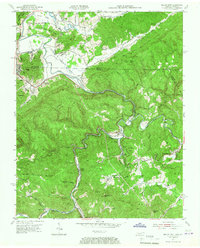
2 editions found
Other maps of this area

1886 · Cumberland Gap
USGS Topo · 1:125,000

1888 · Cumberland Gap
USGS Topo · 1:125,000

1890 · Williamsburg
USGS Topo · 1:125,000

1891 · Cumberland Gap
USGS Topo · 1:125,000

1893 · Briceville
USGS Topo · 1:125,000

1894 · Williamsburg
USGS Topo · 1:125,000

1895 · Briceville
USGS Topo · 1:125,000

1896 · Briceville
USGS Topo · 1:125,000

1897 · Maynardville
USGS Topo · 1:125,000

1900 · Maynardville
USGS Topo · 1:125,000