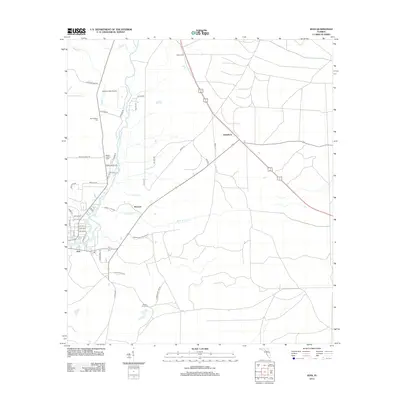
2012 Map of Jena
USGS Topo · Published 2012About this map
The Steinhatchee River defines the western edge of this coastal Florida landscape, winding southward toward the Gulf of Mexico. This 2012 survey illustrates the distinct settlement patterns of Dixie County, where the riverside community of Jena contrasts with the inland crossroads of Broscan and Jonesboro. The geography is shaped by numerous watercourses, including Sand Hill Cr, Boggy Cr, and Boat Cr, which drain the low-lying wetlands. Local history and genealogy are anchored by several remote burial sites such as Mingo Cem, Steinhatchee Cem, and Mount Olive Cem. Industrial and infrastructure markers, like the McCain Lookout Tower and the small Ancient Oaks Airport, highlight the region's reliance on timber management and private aviation in this era of the early 21st century.
Find a feature on this map
45 named features on this map. Tap any name to fly to it.
Don’t see what you’re looking for? This feature index may not catch every label — zoom into the map to look around manually.
Map Details
Editions of this 2012 Jena Map
This is the sole edition of this map. No revisions or reprints were ever made.
Other maps of this area

1954 · Steinhatchee SW
USGS Topo · 1:24,000

1954 · Cross City West
USGS Topo · 1:24,000

1954 · Clara
USGS Topo · 1:24,000

1954 · Salem SW
USGS Topo · 1:24,000

1954 · Mallory Swamp SW
USGS Topo · 1:24,000

1954 · Jena
USGS Topo · 1:24,000

1954 · Steinhatchee
USGS Topo · 1:24,000

1954 · Steinhatchee SE
USGS Topo · 1:24,000

1954 · Cross City SW
USGS Topo · 1:24,000

1954 · Gainesville
USGS Topo · 1:250,000