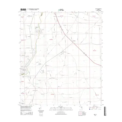
2015 Map of Jena
USGS Topo · Published 2015About this map
The Steinhatchee River serves as the central boundary between Taylor and Dixie Counties, anchoring a coastal landscape defined by low-lying wetlands and scattered settlements. In this 2015 survey, the communities of Steinhatchee and Jena face each other across the river near its mouth, connected by a network of local roads such as River Rd NE and 1st Ave S. Further inland, the settlements of Jonesboro and Broscan sit among a grid of timber and rural tracks, including the Old Steinhatchee Grade. Genealogy and local history researchers can identify family-named landmarks such as Mingo Cem, Steinhatchee Cem, and Mount Olive Cem. The terrain is deeply intertwined with water, featuring small drainages like Sand Hill Cr, Boggy Cr, and Boat Cr that snake through the pine flatwoods and swamps characteristic of this section of the Florida Gulf Coast.
Find a feature on this map
132 named features on this map. Tap any name to fly to it.
Don’t see what you’re looking for? This feature index may not catch every label — zoom into the map to look around manually.
Map Details
Editions of this 2015 Jena Map
This is the sole edition of this map. No revisions or reprints were ever made.
Other maps of this area

1954 · Steinhatchee SW
USGS Topo · 1:24,000

1954 · Cross City West
USGS Topo · 1:24,000

1954 · Clara
USGS Topo · 1:24,000

1954 · Salem SW
USGS Topo · 1:24,000

1954 · Mallory Swamp SW
USGS Topo · 1:24,000

1954 · Jena
USGS Topo · 1:24,000

1954 · Steinhatchee
USGS Topo · 1:24,000

1954 · Steinhatchee SE
USGS Topo · 1:24,000

1954 · Cross City SW
USGS Topo · 1:24,000

1954 · Gainesville
USGS Topo · 1:250,000