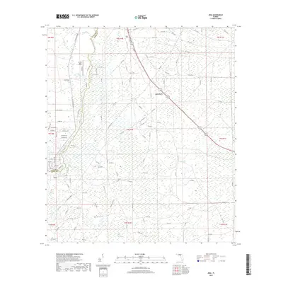
2018 Map of Jena
USGS Topo · Published 2018About this map
The Steinhatchee River forms a natural corridor through this coastal section of Florida, marking the border between Taylor and Dixie counties. This landscape is characterized by a high concentration of wetland systems, including Pumpkin Swamp, Pine Log Swamp, and Rocky Creek Swamp. These marshes are interspersed with small settlements and family landmarks that define the region's rural character. In the southern portion of the map, the community of Jena sits near the river, while Jonesboro serves as a point of interest further inland. Local history is anchored by several burial grounds, such as Mount Olive Cem, Steinhatchee Cem, and Mingo Cem, which provide valuable location data for genealogists tracing families in the Big Bend area. The presence of Ancient Oaks Airport and a network of secondary roads, like River Rd and St Linhatchee Dr, illustrates the modern accessibility of this otherwise water-dominant terrain.
Find a feature on this map
118 named features on this map. Tap any name to fly to it.
Don’t see what you’re looking for? This feature index may not catch every label — zoom into the map to look around manually.
Map Details
Editions of this 2018 Jena Map
This is the sole edition of this map. No revisions or reprints were ever made.
Other maps of this area

1954 · Steinhatchee SW
USGS Topo · 1:24,000

1954 · Cross City West
USGS Topo · 1:24,000

1954 · Clara
USGS Topo · 1:24,000

1954 · Salem SW
USGS Topo · 1:24,000

1954 · Mallory Swamp SW
USGS Topo · 1:24,000

1954 · Jena
USGS Topo · 1:24,000

1954 · Steinhatchee
USGS Topo · 1:24,000

1954 · Steinhatchee SE
USGS Topo · 1:24,000

1954 · Cross City SW
USGS Topo · 1:24,000

1954 · Gainesville
USGS Topo · 1:250,000