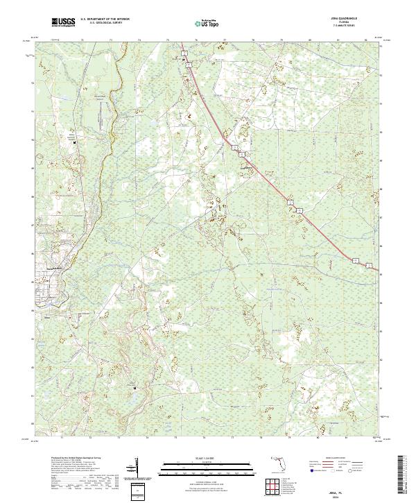
2024 Map of Jena
USGS Topo · Published 2024About this map
Steinhatchee and Jena sit on opposite banks of the Steinhatchee River in this coastal region of Dixie and Taylor counties. The landscape is defined by extensive wetlands, including Pumpkin Swamp, Pine Log Swamp, and Rocky Creek Swamp, which dictate the placement of local infrastructure. To the north, the small settlement of Jonesboro lies along Co Rd 55, surrounded by a dense grid of forestry roads and county routes. For genealogists and local historians, several key landmarks are documented, including Mount Olive Cem and Mingo Cem, along with Waters Memorial Gardens. The map also captures specialized transit points like Ancient Oaks Airport. The transition from the tidal waters of the river to the interior swamps illustrates the traditional reliance on the river as a focal point for settlement in this part of Florida.
Find a feature on this map
126 named features on this map. Tap any name to fly to it.
Don’t see what you’re looking for? This feature index may not catch every label — zoom into the map to look around manually.
Map Details
Editions of this 2024 Jena Map
This is the sole edition of this map. No revisions or reprints were ever made.
Other maps of this area

1954 · Steinhatchee SW
USGS Topo · 1:24,000

1954 · Cross City West
USGS Topo · 1:24,000

1954 · Clara
USGS Topo · 1:24,000

1954 · Salem SW
USGS Topo · 1:24,000

1954 · Mallory Swamp SW
USGS Topo · 1:24,000

1954 · Jena
USGS Topo · 1:24,000

1954 · Steinhatchee
USGS Topo · 1:24,000

1954 · Steinhatchee SE
USGS Topo · 1:24,000

1954 · Cross City SW
USGS Topo · 1:24,000

1954 · Gainesville
USGS Topo · 1:250,000