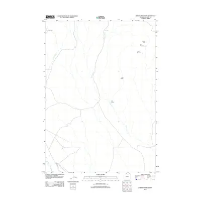
2012 Map of Jenkins Mountain
USGS Topo · Published 2012About this map
Jenkins Mountain and the Owl Creek Mountains define this section of Fremont County, where the high-altitude terrain is marked by isolated structures like the Leisner Cabin and Green Cabin. The landscape is carved by seasonal drainages including Cottonwood Cr, E Fork Sheep Cr, and Muddy Cr, which flow through features such as Trail Canyon and the Jenkins Basin. This 2012 survey illustrates the sparse human footprint in this part of Wyoming, where infrastructure is limited to the lone Shotgun Butte Rd navigating the wide gaps between landmarks like the Twin Buttes. The placement of specific named cabins suggests a history of ranching or remote habitation within these mountain basins.
Find a feature on this map
11 named features on this map. Tap any name to fly to it.
Don’t see what you’re looking for? This feature index may not catch every label — zoom into the map to look around manually.
Map Details
Editions of this 2012 Jenkins Mountain Map
This is the sole edition of this map. No revisions or reprints were ever made.
Other maps of this area

1950 · Pavillion Butte
USGS Topo · 1:24,000

1950 · Harris Bridge
USGS Topo · 1:24,000

1950 · Mexican Pass SW
USGS Topo · 1:24,000

1950 · Shotgun Butte
USGS Topo · 1:24,000

1951 · Mexican Pass
USGS Topo · 1:24,000

1951 · Jenkins Mountain
USGS Topo · 1:24,000

1952 · Kates Basin
USGS Topo · 1:24,000

1952 · Sheep Ridge
USGS Topo · 1:24,000

1955 · Thermopolis
USGS Topo · 1:250,000
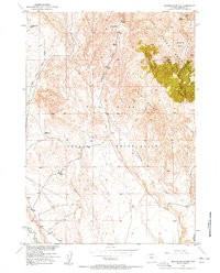
1957 · Jenkins Mountain
USGS Topo · 1:24,000