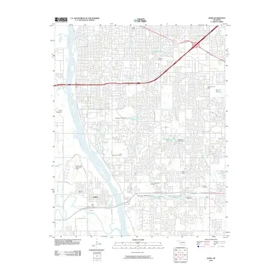
2010 Map of Jenks
USGS Topo · Published 2010About this map
The Arkansas River carves a path through this dense suburban landscape south of Tulsa, where the mid-20th-century expansion of Jenks and surrounding communities is clearly visible. The prominent campus of Oral Roberts University and the striking City of Faith complex serve as major landmarks, reflecting the area's development into a regional center for education and healthcare. Low-lying terrain near the river is protected by the Jenks Levee, while to the west, Turkey Mountain provides a significant break in the urban grid. The map reveals an intricate network of residential enclaves like Harvard Village and Twin Hills, alongside massive modern infrastructure including the Creek Tpke and the Richard Lloyd Jones Junior Airport. Genealogists will find the locations of Memorial Park Cemetery, Booker T Washington Cemetery, and Haikey Cemetery essential for tracing local family histories amidst the rapid growth of the late twentieth century.
Find a feature on this map
48 named features on this map. Tap any name to fly to it.
Don’t see what you’re looking for? This feature index may not catch every label — zoom into the map to look around manually.
Map Details
Editions of this 2010 Jenks Map
This is the sole edition of this map. No revisions or reprints were ever made.
Other maps of this area

1896 · Okmulgee
USGS Topo · 1:125,000

1900 · Okmulgee
USGS Topo · 1:125,000

1901 · Claremore
USGS Topo · 1:125,000

1901 · Nuyaka
USGS Topo · 1:125,000

1912 · Hominy
USGS Topo · 1:125,000

1914 · Kiefer
USGS Topo · 1:62,500

1914 · Claremore
USGS Topo · 1:125,000

1915 · Hominy
USGS Topo · 1:125,000

1916 · Kiefer
USGS Topo · 1:62,500

1916 · Claremore
USGS Topo · 1:125,000