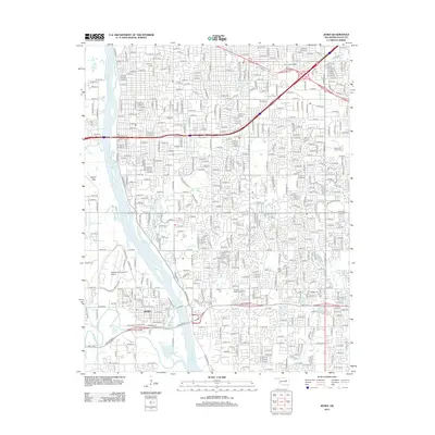
2012 Map of Jenks
USGS Topo · Published 2012About this map
The Arkansas River divides this portion of the Tulsa metro area, with the city of Jenks appearing on the west bank and significant suburban growth expanding to the east. Modern infrastructure dominates the landscape, defined by the Creek Tpke E and Creek Tpke W corridors. Historical grounding is preserved through several family and community burial grounds, including the Perryman Cem and Booker T Washington Cem. The map shows a high concentration of educational institutions, such as Oral Roberts Univ and Tulsa Community Coll, alongside specialized campuses like the Clary Sage College. Aviation is represented by the Richard Lloyd Jones Jr Airport, while the Jenks Levee and Turkey Mtn illustrate the ongoing management of the river valley's natural topography.
Find a feature on this map
35 named features on this map. Tap any name to fly to it.
Don’t see what you’re looking for? This feature index may not catch every label — zoom into the map to look around manually.
Map Details
Editions of this 2012 Jenks Map
This is the sole edition of this map. No revisions or reprints were ever made.
Other maps of this area

1896 · Okmulgee
USGS Topo · 1:125,000

1900 · Okmulgee
USGS Topo · 1:125,000

1901 · Claremore
USGS Topo · 1:125,000

1901 · Nuyaka
USGS Topo · 1:125,000

1912 · Hominy
USGS Topo · 1:125,000

1914 · Kiefer
USGS Topo · 1:62,500

1914 · Claremore
USGS Topo · 1:125,000

1915 · Hominy
USGS Topo · 1:125,000

1916 · Kiefer
USGS Topo · 1:62,500

1916 · Claremore
USGS Topo · 1:125,000