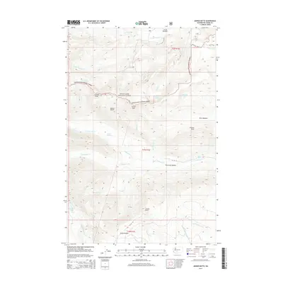
2014 Map of Jennies Butte
USGS Topo · Published 2014About this map
S Fork Tieton River and the upper reaches of the Klickitat River define this high-elevation wilderness within the Snoqualmie National Forest. The landscape is a network of named meadows and ridges, including Conrad Meadows to the north and Hussey Meadow to the south. Distinctive landmarks like Jennies Butte and Diamond Butte punctuate the terrain, while the Klickton Divide serves as a prominent geographic boundary. The map documents a watershed where numerous creeks, such as Elkhorn Cr and McCreedy Cr, drain the slopes of Petross Sidehill and Spencer Point. Local features like Soda Spring and the Cedar Swamp indicate a varied ecology of wetlands and springs that have long shaped the character of this part of Yakima County. This 2014 survey records the Forest Service road network, including Nat For Dev Rd 1070, which provides access to these remote subalpine basins.
Find a feature on this map
36 named features on this map. Tap any name to fly to it.
Don’t see what you’re looking for? This feature index may not catch every label — zoom into the map to look around manually.
Map Details
Editions of this 2014 Jennies Butte Map
This is the sole edition of this map. No revisions or reprints were ever made.
Other maps of this area

1902 · Mount Aix
USGS Topo · 1:125,000

1904 · Mt Aix
USGS Topo · 1:125,000

1904 · Mount Adams
USGS Topo · 1:125,000

1907 · Mount Adams
USGS Topo · 1:125,000

1950 · Yakima
USGS Topo · 1:250,000

1958 · Yakima
USGS Topo · 1:250,000

1961 · Yakima
USGS Topo · 1:250,000

1962 · White Pass
USGS Topo · 1:62,500

1967 · Darland Mtn
USGS Topo · 1:24,000
1969 · Castile Falls
USGS Topo · 1:24,000