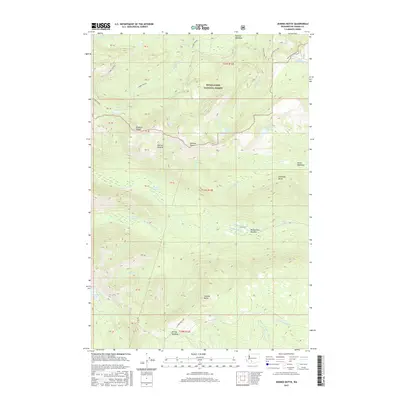
2017 Map of Jennies Butte
USGS Topo · Published 2017About this map
Snoqualmie National Forest dominates this landscape in Yakima County, characterized by a complex network of high-elevation meadows and alpine lakes. The terrain is defined by prominent peaks like Jennies Butte and Diamond Butte, which overlook the headwaters of the Klickitat River and the S Fork Tieton River. Historically significant clearings such as Conrad Meadows, McCormick Meadow, and Hussey Meadow appear as islands of open space amidst the timbered slopes. The presence of several backcountry water bodies, including Surprise Lake, Cirque Lake, and Diamond Lake, highlights the glaciated character of the Klickton Divide. Access to these remote reaches is traced through primitive routes like the Ten Day Trail and the 4WD Divide Ridge W, while the unique Soda Spring and the Huckleberry Swamp provide specialized ecological markers within this mountain wilderness.
Find a feature on this map
49 named features on this map. Tap any name to fly to it.
Don’t see what you’re looking for? This feature index may not catch every label — zoom into the map to look around manually.
Map Details
Editions of this 2017 Jennies Butte Map
This is the sole edition of this map. No revisions or reprints were ever made.
Other maps of this area

1902 · Mount Aix
USGS Topo · 1:125,000

1904 · Mt Aix
USGS Topo · 1:125,000

1904 · Mount Adams
USGS Topo · 1:125,000

1907 · Mount Adams
USGS Topo · 1:125,000

1950 · Yakima
USGS Topo · 1:250,000

1958 · Yakima
USGS Topo · 1:250,000

1961 · Yakima
USGS Topo · 1:250,000

1962 · White Pass
USGS Topo · 1:62,500

1967 · Darland Mtn
USGS Topo · 1:24,000
1969 · Castile Falls
USGS Topo · 1:24,000