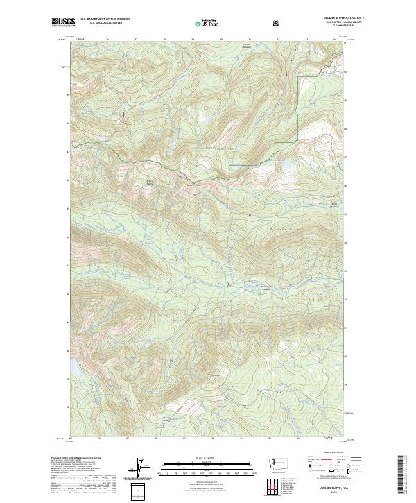
2023 Map of Jennies Butte
USGS Topo · Published 2023About this map
Snoqualmie National Forest defines the high-country landscape of this Yakima County region, where the Goat Rocks Wilderness occupies the northwestern corner. The terrain is a network of ridges and high points, including the namesake Jennies Butte and the prominent Diamond Butte. Between these peaks, a system of subalpine meadows and swamps provides a distinct hydrological pattern, from the expansive Conrad Meadows in the north to the smaller Hussey Meadow and McCormick Meadow further south.
Find a feature on this map
38 named features on this map. Tap any name to fly to it.
Don’t see what you’re looking for? This feature index may not catch every label — zoom into the map to look around manually.
Map Details
Editions of this 2023 Jennies Butte Map
This is the sole edition of this map. No revisions or reprints were ever made.
Other maps of this area

1902 · Mount Aix
USGS Topo · 1:125,000

1904 · Mt Aix
USGS Topo · 1:125,000

1904 · Mount Adams
USGS Topo · 1:125,000

1907 · Mount Adams
USGS Topo · 1:125,000

1950 · Yakima
USGS Topo · 1:250,000

1958 · Yakima
USGS Topo · 1:250,000

1961 · Yakima
USGS Topo · 1:250,000

1962 · White Pass
USGS Topo · 1:62,500

1967 · Darland Mtn
USGS Topo · 1:24,000
1969 · Castile Falls
USGS Topo · 1:24,000