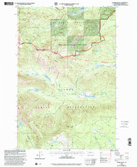
2000 Map of Jennies Butte
USGS Topo · Published 2001About this map
Yakama Indian Reservation lands and the Goat Rocks Wilderness dominate this high-elevation landscape at the turn of the millennium. The map illustrates a complex of administrative and historic boundaries, including the (Campbell Line 1906-07), which partitions the forested ridges and alpine meadows. The terrain is defined by dramatic elevations ranging from the heights of Jennies Butte and Diamond Butte to the riparian flats of Conrad Meadows and Butte Meadows. These wet meadows, alongside features like Huckleberry Swamp and Teddy Swamp, suggest a landscape shaped by significant seasonal snowmelt and a high water table.
Find a feature on this map
40 named features on this map. Tap any name to fly to it.
Don’t see what you’re looking for? This feature index may not catch every label — zoom into the map to look around manually.
Map Details
Editions of this 2000 Jennies Butte Map
This is the sole edition of this map. No revisions or reprints were ever made.
Other maps of this area

1902 · Mount Aix
USGS Topo · 1:125,000

1904 · Mt Aix
USGS Topo · 1:125,000

1904 · Mount Adams
USGS Topo · 1:125,000

1907 · Mount Adams
USGS Topo · 1:125,000

1950 · Yakima
USGS Topo · 1:250,000

1958 · Yakima
USGS Topo · 1:250,000

1961 · Yakima
USGS Topo · 1:250,000

1962 · White Pass
USGS Topo · 1:62,500

1967 · Darland Mtn
USGS Topo · 1:24,000
1969 · Castile Falls
USGS Topo · 1:24,000