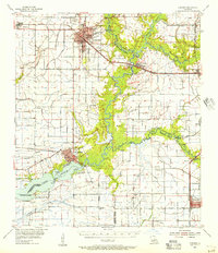
1955 Map of Jennings
USGS Topo · Published 1956About this map
The Mermentau River snakes through the center of this mid-century survey, defining the boundaries of Acadia, Jefferson Davis, and Vermilion Parishes. In Jennings, the local landscape is shaped by the energy industry and transportation, featuring the Jennings Airport, a Drive-in Theater, and the Southern Pacific railroad corridor. Further south, the town of Lake Arthur sits at the edge of its namesake Lake Arthur, where the wetlands transition into the coastal prairie.
Find a feature on this map
45 named features on this map. Tap any name to fly to it.
Don’t see what you’re looking for? This feature index may not catch every label — zoom into the map to look around manually.
Map Details
Editions of this 1955 Jennings Map
4 editions found
Other maps of this area

1934 · Latania Lake
USGS Topo · 1:24,000

1935 · Latania Lake
USGS Topo · 1:31,680

1946 · Morse
USGS Topo · 1:31,680

1946 · Lake Arthur
USGS Topo · 1:31,680

1946 · Schooner Bayou NW
USGS Topo · 1:31,680

1946 · Mermentau
USGS Topo · 1:31,680

1946 · Jennings
USGS Topo · 1:31,680

1947 · Evangeline
USGS Topo · 1:31,680

1947 · Thornwell
USGS Topo · 1:31,680

1947 · Pine Island
USGS Topo · 1:31,680