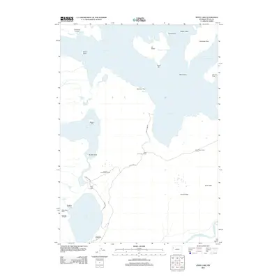
2012 Map of Jenny Lake
USGS Topo · Published 2012About this map
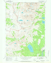
Jenny Lake and the southern reaches of Jackson Lake dominate this 2012 Teton County landscape. The map details a complex aquatic geography of bays and islands, including the large Elk Island and the smaller Marie Island and Badger Island. Long-established recreational sites are central to the area's layout, specifically the Jenny Lake Lodge and Jenny Lake Campground, which are connected by Jenny Lake Rd.
Find a feature on this map
35 named features on this map. Tap any name to fly to it.
Don’t see what you’re looking for? This feature index may not catch every label — zoom into the map to look around manually.
Map Details
Editions of this 2012 Jenny Lake Map
This is the sole edition of this map. No revisions or reprints were ever made.
Other maps of this area

1899 · Grand Teton
USGS Topo · 1:125,000

1901 · Grand Teton
USGS Topo · 1:125,000

1955 · Driggs
USGS Topo · 1:250,000

1958 · Driggs
USGS Topo · 1:250,000

1962 · Driggs
USGS Topo · 1:250,000

1968 · Moose
USGS Topo · 1:24,000
1968 · Ranger Peak
USGS Topo · 1:24,000
1968 · Two Ocean Lake
USGS Topo · 1:24,000
1968 · Shadow Mountain
USGS Topo · 1:24,000
1968 · Grand Teton
USGS Topo · 1:24,000