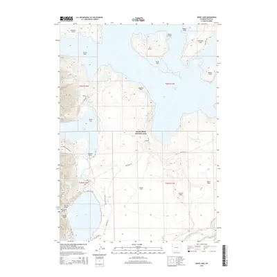
2015 Map of Jenny Lake
USGS Topo · Published 2015About this map
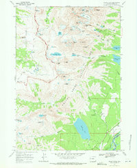
Grand Teton National Park defines this 2015 study of the Teton Range's glacial lakes and the northern reaches of Jackson Hole. This high-elevation landscape is marked by the clear waters of Jackson Lake, Jenny Lake, and Leigh Lake, which are bordered by steep drainages like Cascade Canyon and Paintbrush Canyon. The map reveals a complex network of established routes, including the Jenny Lake Lodge Trail and the Hermitage Point Trail, which navigate the shorelines and timbered ridges. Notable features like Inspiration Point and Mystic Isle serve as key landmarks for those studying the recreational and natural history of the park. The inclusion of Elk Island and Donoho Point illustrates the intricate shoreline of the larger lakes, while the Snake River flows southward through the eastern portion of the quadrangle.
Find a feature on this map
41 named features on this map. Tap any name to fly to it.
Don’t see what you’re looking for? This feature index may not catch every label — zoom into the map to look around manually.
Map Details
Editions of this 2015 Jenny Lake Map
This is the sole edition of this map. No revisions or reprints were ever made.
Other maps of this area

1899 · Grand Teton
USGS Topo · 1:125,000

1901 · Grand Teton
USGS Topo · 1:125,000

1955 · Driggs
USGS Topo · 1:250,000

1958 · Driggs
USGS Topo · 1:250,000

1962 · Driggs
USGS Topo · 1:250,000

1968 · Moose
USGS Topo · 1:24,000
1968 · Ranger Peak
USGS Topo · 1:24,000
1968 · Two Ocean Lake
USGS Topo · 1:24,000
1968 · Shadow Mountain
USGS Topo · 1:24,000
1968 · Grand Teton
USGS Topo · 1:24,000