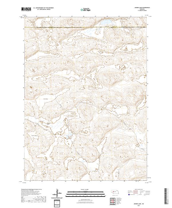
2021 Map of Jensen Lake
USGS Topo · Published 2021About this map
Jensen Lake serves as a central hydrological point in this section of the Nebraska Sandhills, marking the boundary where Arthur and Grant counties meet. The landscape is defined by broad natural depressions, including Voss Valley, Sillasen Valley, and Center Valley, which suggest the traditional cattle ranching routes and grazing lands that have shaped the region's economy for generations. A sparse network of local roads and tracks, such as Rothwell Rd, Dancer Rd, and Sillasen Rd, connect isolated homesteads and ranching outposts across the undulating terrain. The layout of these routes, often following the valley floors or skirting the lake shore, illustrates the necessity of adapting to the area's distinct topography. This survey highlights the intersection of public land survey systems and the enduring names of families, such as Jensen and Sillasen, who have left their mark on the geography of the High Plains.
Find a feature on this map
18 named features on this map. Tap any name to fly to it.
Don’t see what you’re looking for? This feature index may not catch every label — zoom into the map to look around manually.
Map Details
Editions of this 2021 Jensen Lake Map
This is the sole edition of this map. No revisions or reprints were ever made.
Other maps of this area

1948 · George Lake
USGS Topo · 1:62,500

1948 · Spring Valley
USGS Topo · 1:62,500

1949 · Arthur
USGS Topo · 1:62,500

1950 · Spring Valley
USGS Topo · 1:62,500

1950 · Velma
USGS Topo · 1:62,500

1950 · George Lake
USGS Topo · 1:62,500

1950 · Arthur
USGS Topo · 1:62,500

1954 · North Platte
USGS Topo · 1:250,000

1956 · North Platte
USGS Topo · 1:250,000

1957 · North Platte
USGS Topo · 1:250,000