1966 Map of Jensen Ridge
USGS Topo · Published 1968About this map
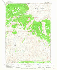
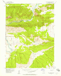
Diamond Mountain Plateau dominates the northern elevation of this landscape, giving way to a complex system of drainage and relief. To the south, the terrain descends toward The Reef, where the Stone Bridge Draw and South Fork Jensen Wash carve through the geological formations. This mid-1960s survey, conducted in cooperation with the U.S. Bureau of Reclamation, documents a high-desert environment utilized for seasonal water management and grazing. Essential water sources for livestock or early settlers are mapped throughout the draws, including Switchback Spring, Blair Spring, and Coal Bed Spring. Man-made improvements to the landscape are evident in the placement of a prominent Pipeline crossing the western sections and the establishment of the Shiner Reservoir and Box Reservoir, reflecting the necessity of water storage on the arid Diamond Mtn slopes.
Find a feature on this map
20 named features on this map. Tap any name to fly to it.
Don’t see what you’re looking for? This feature index may not catch every label — zoom into the map to look around manually.
Map Details
Editions of this 1966 Jensen Ridge Map
This is the sole edition of this map. No revisions or reprints were ever made.
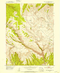
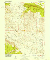
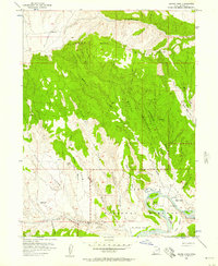
Other maps of this area

1885 · Ashley
USGS Topo · 1:250,000

1907 · Jensen
USGS Topo · 1:125,000

1910 · Jensen
USGS Topo · 1:125,000
1950 · Burnt Cabin Gorge
USGS Topo · 1:24,000
1950 · Blair Basin
USGS Topo · 1:24,000

1954 · Vernal
USGS Topo · 1:250,000
1955 · Island Park
USGS Topo · 1:24,000
1955 · Split Mountain
USGS Topo · 1:24,000

1958 · Vernal
USGS Topo · 1:250,000

1960 · Vernal
USGS Topo · 1:250,000