
1950 Map of Burnt Cabin Gorge
USGS Topo · Published 1952About this map
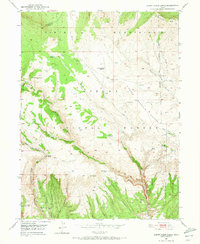
Ashley National Forest dominates this 1950 topographical study, revealing the complex drainage systems of the southern Uinta Mountains. The landscape is defined by the steep descent of Burnt Cabin Gorge and the broad, elevated expanse of the Diamond Mountain Plateau. Early 20th-century land use is evident in livestock-related infrastructure, such as the Diamond Counting Corral and the Counting Station Reservoir, which served the high-country ranching operations common in Uintah County. The map reveals a network of canyons and draws, including Cottonwood Canyon and Dutch Charles Draw, where seasonal water sources like Barker Spring and Hassell Spring provided critical hydration in a high-desert environment. Several mineral survey markers, designated as MS 6907 through MS 6912, point to early 20th-century mining claims and geological exploration in the remote Independence Canyon area.
Find a feature on this map
49 named features on this map. Tap any name to fly to it.
Don’t see what you’re looking for? This feature index may not catch every label — zoom into the map to look around manually.
Map Details
Editions of this 1950 Burnt Cabin Gorge Map
2 editions found
Other maps of this area

1885 · Ashley
USGS Topo · 1:250,000

1906 · Marsh Peak
USGS Topo · 1:125,000

1908 · Marsh Peak
USGS Topo · 1:125,000

1950 · Blair Basin
USGS Topo · 1:24,000

1950 · Dyer Mountain
USGS Topo · 1:24,000

1954 · Vernal
USGS Topo · 1:250,000

1958 · Vernal
USGS Topo · 1:250,000

1960 · Vernal
USGS Topo · 1:250,000
1963 · East Park Reservoir
USGS Topo · 1:24,000
1965 · Steinaker Reservoir
USGS Topo · 1:24,000