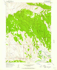
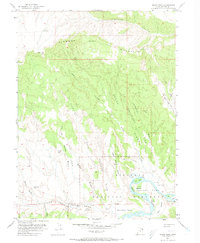
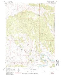
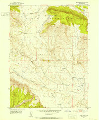
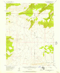
1955 Map of Island Park
USGS Topo · Published 1957About this map
Green River flows through a dramatic canyon landscape in this mid-century survey of the Uintah County wilderness. The river winds past Tree Island and Hog I into the expansive Island Park and Rainbow Park areas, where high plateaus like Diamond Mountain and Wagon Road Bench overlook the water. The presence of Ruple Ranch near the riverbanks indicates the localized ranching history that persisted even as federal protections were established.
Find a feature on this map
34 named features on this map. Tap any name to fly to it.
Don’t see what you’re looking for? This feature index may not catch every label — zoom into the map to look around manually.
Map Details
Editions of this 1955 Island Park Map
3 editions found
Other maps of this area

1885 · Ashley
USGS Topo · 1:250,000

1907 · Jensen
USGS Topo · 1:125,000

1910 · Jensen
USGS Topo · 1:125,000
1950 · Blair Basin
USGS Topo · 1:24,000

1954 · Vernal
USGS Topo · 1:250,000
1955 · Stuntz Reservoir
USGS Topo · 1:24,000
1955 · Jones Hole
USGS Topo · 1:24,000
1955 · Split Mountain
USGS Topo · 1:24,000

1958 · Vernal
USGS Topo · 1:250,000

1960 · Vernal
USGS Topo · 1:250,000