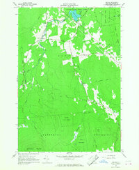
1966 Map of Jericho
USGS Topo · Published 1968About this map
Jericho and the surrounding township of Altona are defined by the rugged interface between dense woodlands and the headwaters of the Great Chazy River in the mid-1960s. The landscape is heavily marked by the Clinton State Forest and the northern slopes of Dannemora Mountain, where the terrain transitions from steep ridges to the Flat Rock plateau. Settled pockets like Jerusalem and Alder Bend appear as modest clearings connected by historic routes such as Military Road and Turnpike Road. Local institutional life is centered around landmarks like St Alexis Ch and the quiet waters of Miner Lake State Park. The map documents a rural Adirondack economy still tied to the land and its drainage systems, including the uniquely named Dead Sea and various brooks like Stillwater Brook and Brandy Brook that feed the river system.
Find a feature on this map
34 named features on this map. Tap any name to fly to it.
Don’t see what you’re looking for? This feature index may not catch every label — zoom into the map to look around manually.
Map Details
Editions of this 1966 Jericho Map
2 editions found
Other maps of this area

1895 · Mooers
USGS Topo · 1:62,500

1899 · Mooers
USGS Topo · 1:62,500

1911 · Lyon Mountain
USGS Topo · 1:62,500

1913 · Dannemora
USGS Topo · 1:62,500

1913 · Lyon Mountain
USGS Topo · 1:62,500

1915 · Churubusco
USGS Topo · 1:62,500

1931 · Lyon Mountain
USGS Topo · 1:62,500

1942 · Mooers
USGS Topo · 1:62,500

1943 · Churubusco
USGS Topo · 1:62,500

1943 · Mooers
USGS Topo · 1:62,500