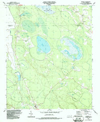
1987 Map of Jerome
USGS Topo · Published 1987About this map
The low-lying wetlands of Bladen and Cumberland counties define this landscape, dominated by the elliptical formations of the Carolina Bays. The Bushy Lake State Natural Area sits at the northern edge, part of a complex hydrological network that includes Little Singletary Lake, Suggs Mill Pond, and dozens of named bays like Big Gallberry Bay and Gum Swamp Bay. These shallow, peat-filled depressions dictate the area's geography, with human settlement relegated to the higher ground between them. Small rural communities like Jerome and White Oak serve as focal points for local life, connected by a series of roads and 4WD tracks. The map is particularly useful for genealogists, as it identifies numerous country churches and cemeteries, including Sharon Ch, China Grove Ch, and Live Oak Ch, which often served as the social heart of these dispersed farming and timbering communities.
Find a feature on this map
52 named features on this map. Tap any name to fly to it.
Don’t see what you’re looking for? This feature index may not catch every label — zoom into the map to look around manually.
Map Details
Editions of this 1987 Jerome Map
This is the sole edition of this map. No revisions or reprints were ever made.
Other maps of this area

1953 · Florence
USGS Topo · 1:250,000

1954 · Florence
USGS Topo · 1:250,000

1955 · Elizabethtown
USGS Topo · 1:62,500

1957 · Bladenboro
USGS Topo · 1:62,500

1959 · Roseboro
USGS Topo · 1:62,500

1959 · Saint Pauls
USGS Topo · 1:62,500

1982 · Elizabethtown
USGS Topo · 1:100,000

1986 · Tar Heel
USGS Topo · 1:24,000
1986 · Duart
USGS Topo · 1:24,000
1986 · Cedar Creek
USGS Topo · 1:24,000