1982 Map of Elizabethtown
USGS Topo · Published 1983About this map
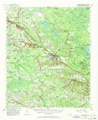
The Cape Fear River and South River define the hydraulic character of this southeastern North Carolina region, where the unique elliptical depressions known as Carolina Bays form a striking natural pattern across the landscape. Notable among these are Singletary Lake, White Lake, and Jones Lake, which are preserved within the extensive Bladen Lakes State Forest and various state parks. These water bodies, along with Bay Tree Lake and Salters Lake, have long served as focal points for recreation and settlement in an area otherwise characterized by dense woodlands and bottomlands.
Find a feature on this map
70 named features on this map. Tap any name to fly to it.
Don’t see what you’re looking for? This feature index may not catch every label — zoom into the map to look around manually.
Map Details
Editions of this 1982 Elizabethtown Map
This is the sole edition of this map. No revisions or reprints were ever made.