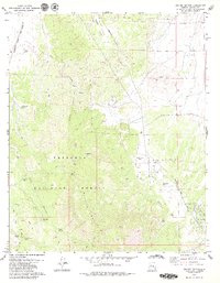
1979 Map of Jerome Canyon
USGS Topo · Published 1979About this map
The American Ranch (Site) serves as a notable historical marker within this high-desert landscape, situated along the Williamson Valley Road. The topography is dominated by the massive profile of Granite Mountain and the steep slopes of Table Mtn, with much of the southwestern quadrant protected as part of the Prescott National Forest. This 1970s survey captures a transition in land use, where rugged livestock grazing and resource extraction are evidenced by scattered prospects, several corrals, and numerous livestock watering points like Stringfield Tank and Shroder Tank. The transportation network is defined by the Atchison Topeka and Santa Fe railroad cutting through the northwest corner, while the interior remains accessible primarily via a network of pack trails and jeep trails crossing through Blair Pass. Numerous natural water sources, including Tin Trough Spring and Cedar Spring, indicate the vital locations where water was accessible in this arid environment.
Find a feature on this map
35 named features on this map. Tap any name to fly to it.
Don’t see what you’re looking for? This feature index may not catch every label — zoom into the map to look around manually.
Map Details
Editions of this 1979 Jerome Canyon Map
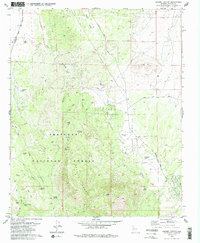
2 editions found
Other maps of this area

1887 · Prescott
USGS Topo · 1:250,000

1892 · Prescott
USGS Topo · 1:250,000

1905 · Jerome
USGS Topo · 1:125,000

1947 · Simmons
USGS Topo · 1:62,500

1947 · Iron Springs
USGS Topo · 1:62,500

1947 · Paulden
USGS Topo · 1:62,500

1947 · Prescott
USGS Topo · 1:62,500

1948 · Iron Springs
USGS Topo · 1:63,360

1948 · Prescott
USGS Topo · 1:62,500

1948 · Simmons
USGS Topo · 1:63,360