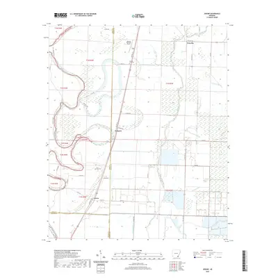
2020 Map of Jerome
USGS Topo · Published 2020About this map
Bayou Bartholomew winds through this delta landscape where the borders of Drew, Chicot, and Ashley counties converge. The topography is defined by its complex drainage network, featuring Big Bayou, Crooked Bayou, and Lighterwood Bayou alongside the distinct elevation of Silver Mound. This area is marked by a history of small agricultural communities and family-named routes, such as C C Gibson Rd and Hudspeth Rd.
Find a feature on this map
44 named features on this map. Tap any name to fly to it.
Don’t see what you’re looking for? This feature index may not catch every label — zoom into the map to look around manually.
Map Details
Editions of this 2020 Jerome Map
This is the sole edition of this map. No revisions or reprints were ever made.
Other maps of this area

1935 · Mist
USGS Topo · 1:62,500

1935 · Cominto
USGS Topo · 1:62,500

1936 · McGehee
USGS Topo · 1:62,500

1936 · Lake Village
USGS Topo · 1:62,500

1937 · McGehee
USGS Topo · 1:62,500

1953 · Greenwood
USGS Topo · 1:250,000

1955 · Lake Village
USGS Topo · 1:62,500

1955 · McGehee
USGS Topo · 1:62,500

1956 · Greenwood
USGS Topo · 1:250,000

1960 · Snyder
USGS Topo · 1:24,000