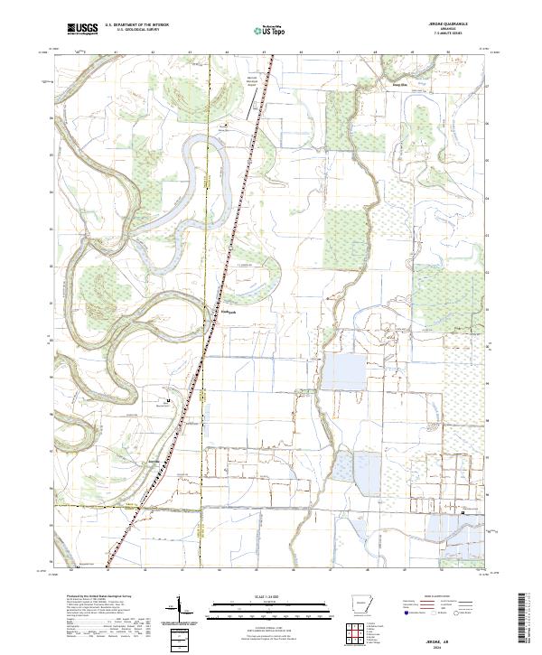
2024 Map of Jerome
USGS Topo · Published 2024About this map
Bayou Bartholomew snakes through the western portion of this landscape, its winding course defining the border between Drew and Chicot counties. The settlement of Jerome sits along Louisiana Blvd, a central point for the surrounding agricultural tracts and drainage networks. To the north, the small community of Hudspeth and the Dermott Municipal Airport mark the transition toward more developed infrastructure.
Find a feature on this map
46 named features on this map. Tap any name to fly to it.
Don’t see what you’re looking for? This feature index may not catch every label — zoom into the map to look around manually.
Map Details
Editions of this 2024 Jerome Map
This is the sole edition of this map. No revisions or reprints were ever made.
Other maps of this area

1935 · Mist
USGS Topo · 1:62,500

1935 · Cominto
USGS Topo · 1:62,500

1936 · McGehee
USGS Topo · 1:62,500

1936 · Lake Village
USGS Topo · 1:62,500

1937 · McGehee
USGS Topo · 1:62,500

1953 · Greenwood
USGS Topo · 1:250,000

1955 · Lake Village
USGS Topo · 1:62,500

1955 · McGehee
USGS Topo · 1:62,500

1956 · Greenwood
USGS Topo · 1:250,000

1960 · Snyder
USGS Topo · 1:24,000