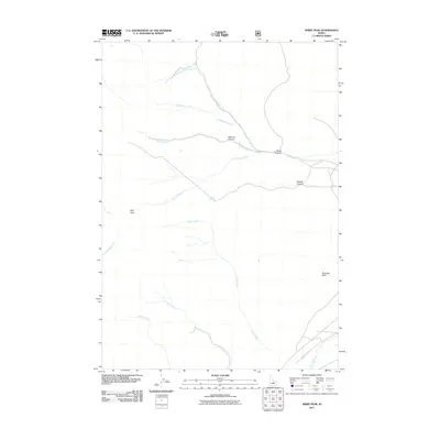
2011 Map of Jerry Peak
USGS Topo · Published 2011About this map
Jerry Peak dominates this high-elevation terrain in Custer County, where the hydrological network of the Big Lost River basin begins its descent through a complex system of canyons. The map documents a landscape defined by seasonal drainages and permanent water sources like Howell Spring, which likely served as a critical waypoint for early high-country ranching and travel. This 2011 survey reveals how the environment is carved by the Pinto Creek and Sage Creek systems, with landmarks such as Sawmill Canyon and Pecks Canyon suggesting a history of local resource extraction and early settlement patterns. To the east, the isolation of Swensen Basin provides a view into the remote grazing lands and wilderness character of central Idaho as it appeared in the early 21st century.
Find a feature on this map
16 named features on this map. Tap any name to fly to it.
Don’t see what you’re looking for? This feature index may not catch every label — zoom into the map to look around manually.
Map Details
Editions of this 2011 Jerry Peak Map
This is the sole edition of this map. No revisions or reprints were ever made.
Other maps of this area

1895 · Hailey
USGS Topo · 1:125,000

1897 · Hailey
USGS Topo · 1:125,000

1929 · Bayhorse
USGS Topo · 1:125,000

1935 · MacKay
USGS Topo · 1:96,000

1935 · Borah Peak
USGS Topo · 1:125,000

1938 · Borah Peak
USGS Topo · 1:125,000

1955 · Dubois
USGS Topo · 1:250,000

1955 · Idaho Falls
USGS Topo · 1:250,000

1955 · Hailey
USGS Topo · 1:250,000

1957 · Challis
USGS Topo · 1:250,000