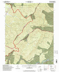
1995 Map of Jerrys Run
USGS Topo · Published 1998About this map
The mountain border between Virginia and West Virginia defines this 1995 survey, centering on the high ridges and deep hollows of the George Washington National Forest and Monongahela National Forest. The landscape is marked by the heavy infrastructure required to traverse the Alleghenies, most notably the series of subterranean passages including Kelly Tunnel, Lewis Tunnels, Lakes Tunnel, and Moores Tunnel. These engineering feats, alongside a prominent Pipeline, follow the natural corridors carved by Dunlap Creek and Jerrys Run.
Find a feature on this map
36 named features on this map. Tap any name to fly to it.
Don’t see what you’re looking for? This feature index may not catch every label — zoom into the map to look around manually.
Map Details
Editions of this 1995 Jerrys Run Map
This is the sole edition of this map. No revisions or reprints were ever made.
Other maps of this area

1887 · Lewisburg
USGS Topo · 1:125,000

1891 · Lewisburg
USGS Topo · 1:125,000

1921 · Callaghan
USGS Topo · 1:48,000

1921 · White Sulphur Springs
USGS Topo · 1:48,000

1921 · Ronceverte
USGS Topo · 1:48,000

1923 · White Sulphur Springs
USGS Topo · 1:62,500

1923 · Ronceverte
USGS Topo · 1:62,500

1923 · Callaghan
USGS Topo · 1:62,500

1935 · White Sulphur Springs
USGS Topo · 1:62,500

1939 · White Sulphur Springs
USGS Topo · 1:62,500