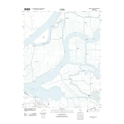
2012 Map of Jersey Island
USGS Topo · Published 2012About this map
Sherman Island and the complex labyrinth of the Sacramento-San Joaquin River Delta define this 2012 survey. The landscape is a network of reclaimed islands and levee-protected lowlands, including Jersey Island and Twitchell Island, separated by deep channels like Threemile Slough and Sevenmile Slough. The residential and recreational hub of Bethel Island is visible in the southeast, characterized by its intricate canal-front properties and marinas. A series of historic river landings, such as Toland Landing, Bradford Landing, and Baldocchi Landing, line the water's edge, serving as reminders of the region's long-standing reliance on river transport. The presence of the Threemile Bridge and the Victory Hwy illustrates the modern infrastructure necessary to navigate this aquatic geography, while the Big Break Marina and Eddos Harbor highlight the area's contemporary role as a gateway for delta boaters and anglers.
Find a feature on this map
80 named features on this map. Tap any name to fly to it.
Don’t see what you’re looking for? This feature index may not catch every label — zoom into the map to look around manually.
Map Details
Editions of this 2012 Jersey Island Map
This is the sole edition of this map. No revisions or reprints were ever made.
Other maps of this area

1896 · Mt. Diablo
USGS Topo · 1:62,500

1898 · Mt. Diablo
USGS Topo · 1:62,500

1907 · Antioch
USGS Topo · 1:62,500

1908 · Antioch
USGS Topo · 1:62,500

1910 · Rio Vista
USGS Topo · 1:31,680

1910 · Bouldin
USGS Topo · 1:31,680

1910 · Jersey
USGS Topo · 1:31,680

1910 · Isleton
USGS Topo · 1:31,680

1913 · Woodward Island
USGS Topo · 1:31,680

1914 · Brentwood
USGS Topo · 1:31,680