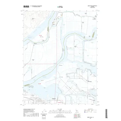
2018 Map of Jersey Island
USGS Topo · Published 2018About this map
Jersey Island and the complex web of the California Delta define this landscape, where the San Joaquin River and Sacramento River converge. This survey highlights the intricate network of sloughs and reclaimed tracts that characterize the region, including Bradford Island, Twitchell Island, and Sherman Island. The city of Oakley anchors the southern boundary, showing modern suburban development near the Marsh Creek Regional Trl.
Find a feature on this map
89 named features on this map. Tap any name to fly to it.
Don’t see what you’re looking for? This feature index may not catch every label — zoom into the map to look around manually.
Map Details
Editions of this 2018 Jersey Island Map
This is the sole edition of this map. No revisions or reprints were ever made.
Other maps of this area

1896 · Mt. Diablo
USGS Topo · 1:62,500

1898 · Mt. Diablo
USGS Topo · 1:62,500

1907 · Antioch
USGS Topo · 1:62,500

1908 · Antioch
USGS Topo · 1:62,500

1910 · Rio Vista
USGS Topo · 1:31,680

1910 · Bouldin
USGS Topo · 1:31,680

1910 · Jersey
USGS Topo · 1:31,680

1910 · Isleton
USGS Topo · 1:31,680

1913 · Woodward Island
USGS Topo · 1:31,680

1914 · Brentwood
USGS Topo · 1:31,680