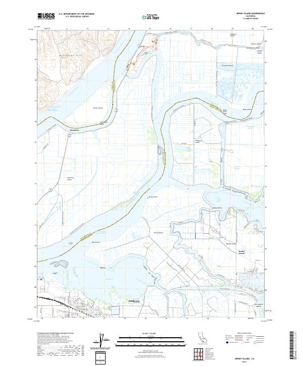
2021 Map of Jersey Island
USGS Topo · Published 2021About this map
Jersey Island and the surrounding labyrinth of the California Delta are shown here at a moment of significant 21st-century water management and agricultural land use. The confluence of the Sacramento River and the San Joaquin River defines the landscape, with deep-draft transit facilitated by the Sacramento River Deep Water Ship Channel and the Stockton Deep Water Channel. These engineered waterways cut through a network of low-lying tracts and islands including Bradford Island, Twitchell Island, and Sherman Island, many protected by levee roads like Sherman Island East Levee Rd. To the south, the expansion of Oakley is visible alongside the residential canals of Bethel Island. This area serves as a critical junction for regional infrastructure, where the Montezuma Hills rise above the reclaimed marshlands of the Sacramento and San Joaquin Valley.
Find a feature on this map
83 named features on this map. Tap any name to fly to it.
Don’t see what you’re looking for? This feature index may not catch every label — zoom into the map to look around manually.
Map Details
Editions of this 2021 Jersey Island Map
This is the sole edition of this map. No revisions or reprints were ever made.
Other maps of this area

1896 · Mt. Diablo
USGS Topo · 1:62,500

1898 · Mt. Diablo
USGS Topo · 1:62,500

1907 · Antioch
USGS Topo · 1:62,500

1908 · Antioch
USGS Topo · 1:62,500

1910 · Rio Vista
USGS Topo · 1:31,680

1910 · Bouldin
USGS Topo · 1:31,680

1910 · Jersey
USGS Topo · 1:31,680

1910 · Isleton
USGS Topo · 1:31,680

1913 · Woodward Island
USGS Topo · 1:31,680

1914 · Brentwood
USGS Topo · 1:31,680