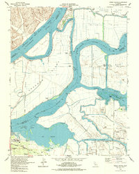
1978 Map of Jersey Island
USGS Topo · Published 1978About this map
Jersey Island and its surrounding delta tracts are defined by a complex network of levees, sloughs, and industrial infrastructure in the late 1970s. The landscape is a study in hydraulic management, where the Sacramento River Deep Water Ship Channel facilitates maritime commerce alongside the extensive Rio Vista Gas Field. This era shows a transition toward leisure and residential use in the southern delta, anchored by the development of Bethel Island with its expanding harbor facilities and the nearby Franks Tract State Recreation Area.
Find a feature on this map
47 named features on this map. Tap any name to fly to it.
Don’t see what you’re looking for? This feature index may not catch every label — zoom into the map to look around manually.
Map Details
Editions of this 1978 Jersey Island Map
This is the sole edition of this map. No revisions or reprints were ever made.
Other maps of this area

1896 · Mt. Diablo
USGS Topo · 1:62,500

1898 · Mt. Diablo
USGS Topo · 1:62,500

1907 · Antioch
USGS Topo · 1:62,500

1908 · Antioch
USGS Topo · 1:62,500

1910 · Rio Vista
USGS Topo · 1:31,680

1910 · Bouldin
USGS Topo · 1:31,680

1910 · Jersey
USGS Topo · 1:31,680

1910 · Isleton
USGS Topo · 1:31,680

1913 · Woodward Island
USGS Topo · 1:31,680

1914 · Brentwood
USGS Topo · 1:31,680