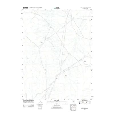
2011 Map of Jersey Summit
USGS Topo · Published 2011About this map
Jersey Summit and the surrounding high desert of Lander County are defined by a network of drainage systems and isolated canyons in this 2011 topographic study. The landscape is marked by the seasonal flow of the Jersey Valley Wash and Indian Creek, which provide the primary hydrological structure for this arid region. Two principal routes, Jersey Valley Rd and Buffalo Valley Rd, intersect near the center of the quadrangle, facilitating movement through the basin and range terrain. Geologic and topographic variation is centered around distinct features such as Blue Lead Canyon, Lone Canyon, and the prominent rise of Squaw Tit to the east. This survey captures the sparse infrastructure of the modern Nevada interior, emphasizing the geographic isolation and the physical pathways established through the canyons and valleys.
Find a feature on this map
8 named features on this map. Tap any name to fly to it.
Don’t see what you’re looking for? This feature index may not catch every label — zoom into the map to look around manually.
Map Details
Editions of this 2011 Jersey Summit Map
This is the sole edition of this map. No revisions or reprints were ever made.
Other maps of this area

1932 · Sonoma Range
USGS Topo · 1:250,000

1939 · Sonoma Range
USGS Topo · 1:250,000

1955 · Winnemucca
USGS Topo · 1:250,000

1958 · Winnemucca
USGS Topo · 1:250,000

1961 · Mt. Tobin
USGS Topo · 1:62,500

1961 · Cain Mountain
USGS Topo · 1:62,500

1961 · Mt. Moses
USGS Topo · 1:62,500

1962 · Winnemucca
USGS Topo · 1:250,000

1962 · Buffalo Springs
USGS Topo · 1:62,500

1982 · Fish Creek Mts
USGS Topo · 1:100,000