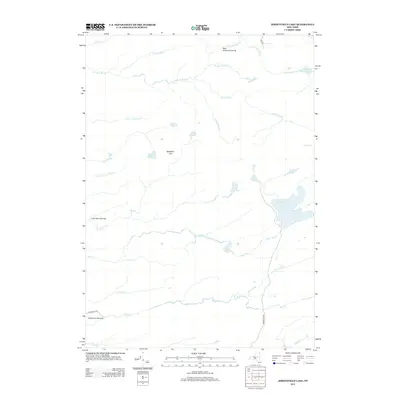
2013 Map of Jerseyfield Lake
USGS Topo · Published 2013About this map
Jerseyfield Lake lies at the heart of this Herkimer County landscape, surrounded by a dense network of watercourses and isolated forest clearings. The terrain is defined by a complex drainage system, where Stony Brook and Mill Cr wind through the southern reaches, while Twomile Brook and Fourmile Brook dominate the north. These waterways converge and split across a territory largely devoid of major modern infrastructure, instead marked by historical landmarks like New Holland Clearing, California Clearing, and Lafe Hall Clearing. Local elevations are anchored by Mosquito Hill, which overlooks the smaller water bodies of Deer Lake and Mounts Gr Lake. The distribution of named clearings and remote ponds suggests a history of forest management and seasonal camps, characteristic of the Adirondack foothills before more intensive development reached the deeper woods.
Find a feature on this map
30 named features on this map. Tap any name to fly to it.
Don’t see what you’re looking for? This feature index may not catch every label — zoom into the map to look around manually.
Map Details
Editions of this 2013 Jerseyfield Lake Map
This is the sole edition of this map. No revisions or reprints were ever made.
Other maps of this area

1900 · Little Falls
USGS Topo · 1:62,500

1900 · Wilmurt
USGS Topo · 1:62,500

1901 · Lassellsville
USGS Topo · 1:62,500

1902 · Wilmurt
USGS Topo · 1:62,500

1903 · Lassellsville
USGS Topo · 1:62,500

1903 · Little Falls
USGS Topo · 1:62,500

1904 · Piseco Lake
USGS Topo · 1:62,500

1906 · Piseco Lake
USGS Topo · 1:62,500

1908 · Piseco Lake
USGS Topo · 1:62,500

1939 · Little Falls
USGS Topo · 1:62,500