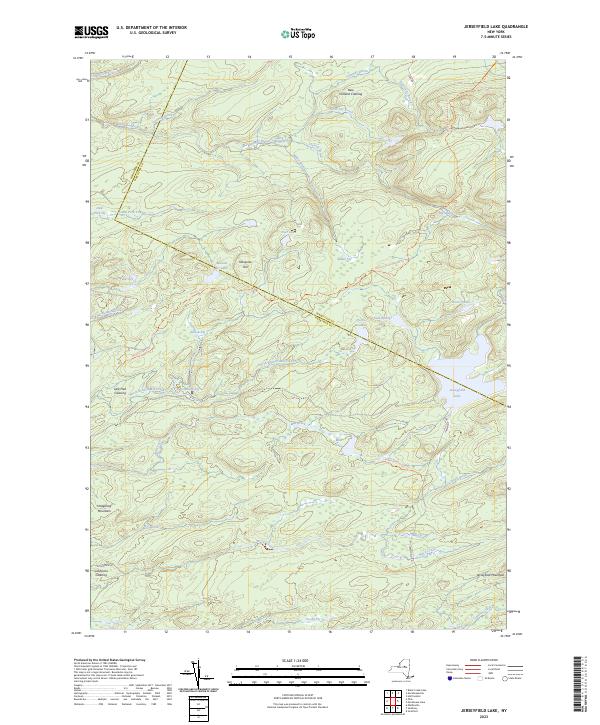
2023 Map of Jerseyfield Lake
USGS Topo · Published 2023About this map
Jerseyfield Lake lies at the heart of this landscape, situated along the county boundary between Herkimer and Hamilton counties. The area is defined by a complex network of wetlands and waterways, including the winding Mill Creek and Fourmile Brook. Scattered throughout this wooded terrain are named clearings such as New Holland Clearing, Lafe Hall Clearing, and California Clearing, which suggest a history of isolated settlement or timber operations in a region where elevation is punctuated by landmarks like Hedgehog Mountain and Mosquito Hill.
Find a feature on this map
45 named features on this map. Tap any name to fly to it.
Don’t see what you’re looking for? This feature index may not catch every label — zoom into the map to look around manually.
Map Details
Editions of this 2023 Jerseyfield Lake Map
This is the sole edition of this map. No revisions or reprints were ever made.
Other maps of this area

1900 · Little Falls
USGS Topo · 1:62,500

1900 · Wilmurt
USGS Topo · 1:62,500

1901 · Lassellsville
USGS Topo · 1:62,500

1902 · Wilmurt
USGS Topo · 1:62,500

1903 · Lassellsville
USGS Topo · 1:62,500

1903 · Little Falls
USGS Topo · 1:62,500

1904 · Piseco Lake
USGS Topo · 1:62,500

1906 · Piseco Lake
USGS Topo · 1:62,500

1908 · Piseco Lake
USGS Topo · 1:62,500

1939 · Little Falls
USGS Topo · 1:62,500