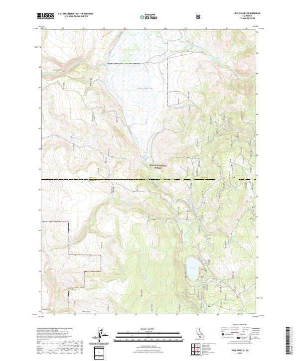
2021 Map of Jess Valley
USGS Topo · Published 2021About this map
Jess Valley and the Warner Mountains dominate this high-country landscape within the Modoc National Forest. This survey captures the complex drainage patterns of the region, where the S Fork Pit River and its numerous tributaries like Harvey Cr and Mill Cr flow through the valley floor. The geography is defined by significant elevation changes, moving from the level expanse of the valley up to the prominent Mahogany Ridge and down into the depths of Deep Canyon.
Find a feature on this map
25 named features on this map. Tap any name to fly to it.
Don’t see what you’re looking for? This feature index may not catch every label — zoom into the map to look around manually.
Map Details
Editions of this 2021 Jess Valley Map
This is the sole edition of this map. No revisions or reprints were ever made.
Other maps of this area

1886 · Alturas
USGS Topo · 1:250,000

1892 · Alturas
USGS Topo · 1:250,000

1954 · Alturas
USGS Topo · 1:250,000

1958 · Alturas
USGS Topo · 1:250,000

1962 · Alturas
USGS Topo · 1:250,000

1962 · Tule Mountain
USGS Topo · 1:24,000
1962 · Madeline
USGS Topo · 1:24,000
1962 · Cold Spring Mtn
USGS Topo · 1:24,000

1962 · Jess Valley
USGS Topo · 1:24,000
1962 · Emerson Peak
USGS Topo · 1:24,000