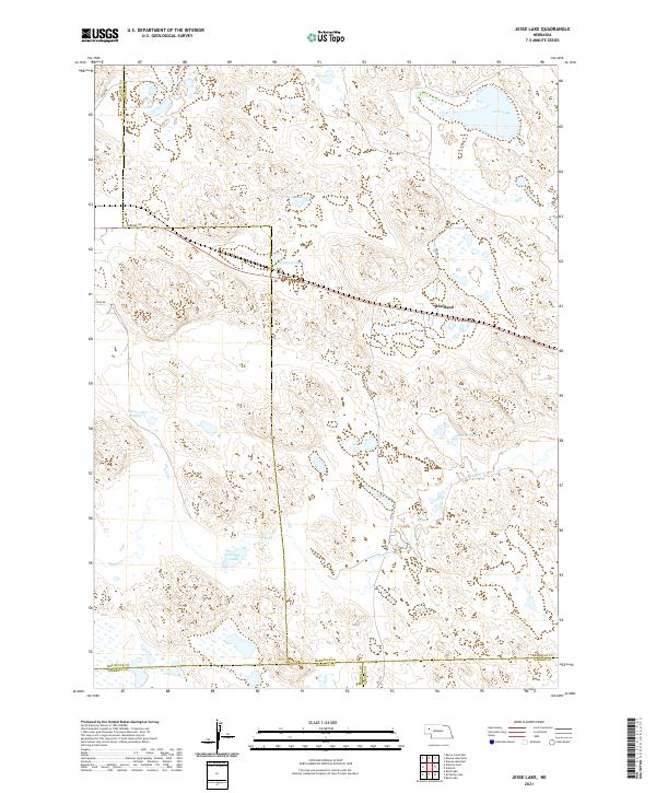
2021 Map of Jesse Lake
USGS Topo · Published 2021About this map
Hoffland stands as a focal point in this portion of the Nebraska Sandhills, located along a rail corridor and surrounded by a complex network of alkaline lakes and drainage systems. The landscape is defined by the shifting hydrology of the region, featuring prominent water bodies such as Jesse Lake and O'Neil Lake in the north, and the meandering course of Snake Cr further south. These lakes often fluctuate with groundwater levels, a characteristic feature of the Sheridan County terrain where ranching and local transport have long adapted to the sandy, interdunal depressions.
Find a feature on this map
27 named features on this map. Tap any name to fly to it.
Don’t see what you’re looking for? This feature index may not catch every label — zoom into the map to look around manually.
Map Details
Editions of this 2021 Jesse Lake Map
This is the sole edition of this map. No revisions or reprints were ever made.
Other maps of this area

1896 · Browns Creek
USGS Topo · 1:125,000

1899 · Browns Creek
USGS Topo · 1:125,000

1946 · Berea Creek East
USGS Topo · 1:24,000

1947 · Alliance
USGS Topo · 1:24,000

1948 · Berea Creek East
USGS Topo · 1:24,000

1948 · Alliance
USGS Topo · 1:24,000

1948 · Antioch
USGS Topo · 1:62,500

1949 · Lynn
USGS Topo · 1:62,500

1949 · Antioch
USGS Topo · 1:62,500

1950 · Storm Lake
USGS Topo · 1:62,500